5-Day North Vancouver Island Road Trip
Vancouver to Port Hardy Itinerary
Vancouver Island's northern region remains one of BC's best-kept secrets. While southern destinations like Victoria and Tofino draw crowds, the route from Campbell River to Port Hardy offers authentic wilderness experiences with minimal tourist infrastructure. You'll drive the scenic Highway 19 through ancient rainforests, witness some of the Island's most dramatic waterfalls, and reach Cape Scott Provincial Park - a place so remote it requires a 2-hour drive on logging roads just to access the trailhead.
It's an expedition into Canada's coastal wilderness where cell service disappears, wildlife encounters are common, and the beaches rival anything in the Pacific Northwest.
This 5-day journey covers approximately 1,300 km from Vancouver's Duke Point ferry to Port Hardy's remote wilderness, featuring 10+ waterfalls, ancient caves, old-growth rainforests, and access to what many consider Canada's most beautiful beach at San Josef Bay.
Quick comparison of Squamish Trails
Sea to Sky Gondola
- Distance: 7.5 km (one-way)
- Elevation Gain: 918 meters
- Difficulty: Moderate
- Highlights: Forest trails, waterfalls, Howe Sound views, gondola descent option
Shannon Falls Pools
- Distance: 2 km (round trip)
- Elevation Gain: 220 meters
- Difficulty: Moderate
- Highlights: Waterfall views, chain-assisted sections, forest setting
Jurassic Ridge
- Distance: 2.5 km (loop)
- Elevation Gain: 300 meters
- Difficulty: Moderate
- Highlights: Multiple scenic viewpoints, unique rock formations, swimming lake
Crooked Falls
- Distance: 6 km (round trip)
- Elevation Gain: 350 meters
- Difficulty: Moderate
- Highlights: Old-growth forest, two different waterfall viewpoints
Cheakamus High Tantalus
- Distance: 5 km (round trip)
- Elevation Gain: 150 meters
- Difficulty: Easy
- Highlights: Mountain views, river scenery, eagle habitat
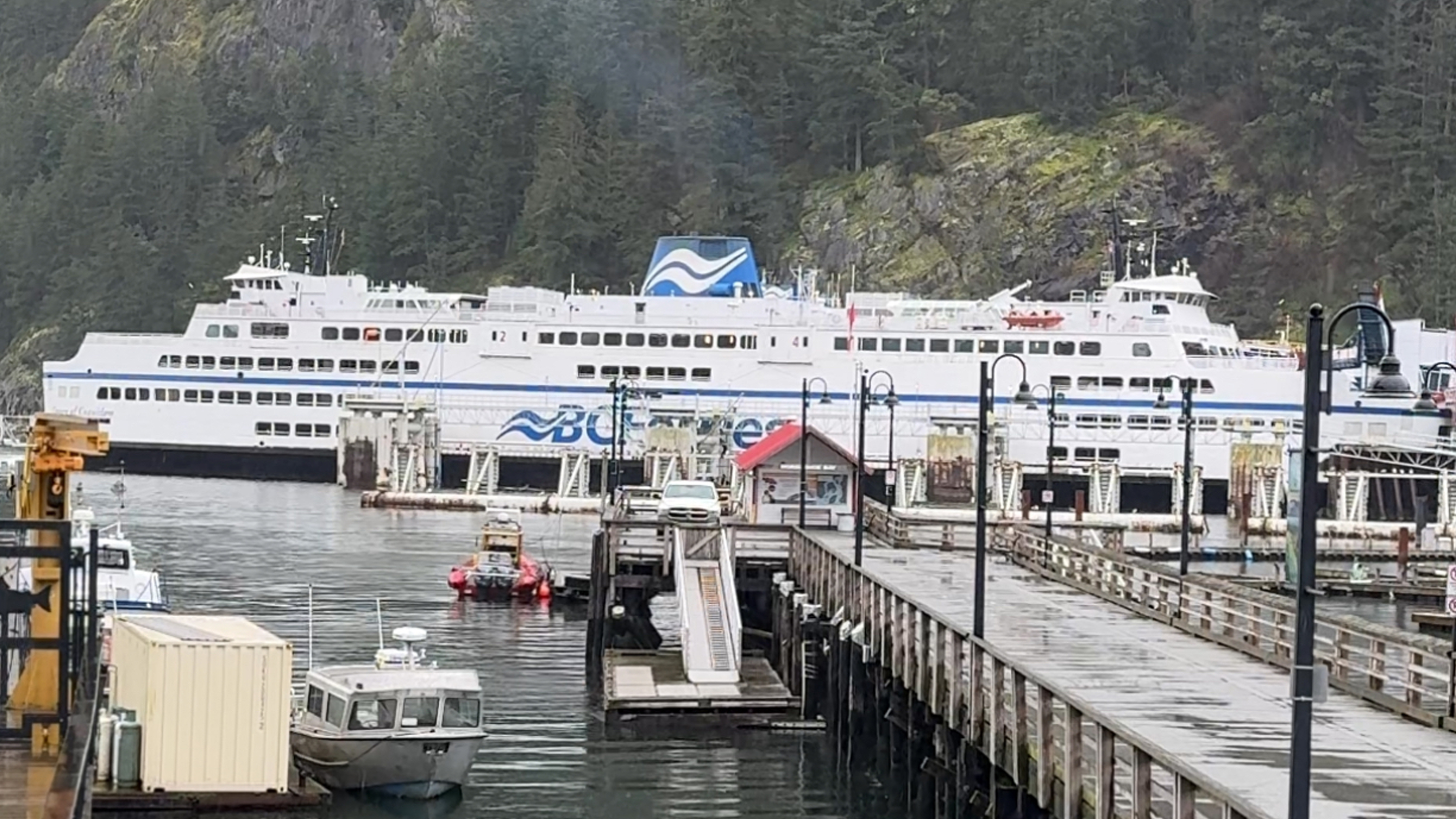
Day 1: Nanaimo to Campbell River
Distance: 7.5 km one-way | Elevation Gain: 918 meters | Difficulty: Moderate
Nymph Falls (Comox Valley) Easy 0.5 km wheelchair-friendly trail to spectacular Puntledge River cascades. Features fish ladder where salmon leap during October-November runs. Designated parking with accessible facilities. Late afternoon sun illuminates the cascade perfectly, and mid-morning light captures the fish ladder action during salmon season.
Browns River Falls ("Medicine Bowls") 1.2 km round-trip with moderate difficulty. Series of cascades flowing into circular rock "bowls" - hence the local name "Medicine Bowls." Trail follows old powerline road before rope-assisted descent to base (60m elevation change). Access via yellow gate on Piercy Road. Final approach requires using ropes and not suitable for young children. Summer visits offer warm pothole pools perfect for swimming.
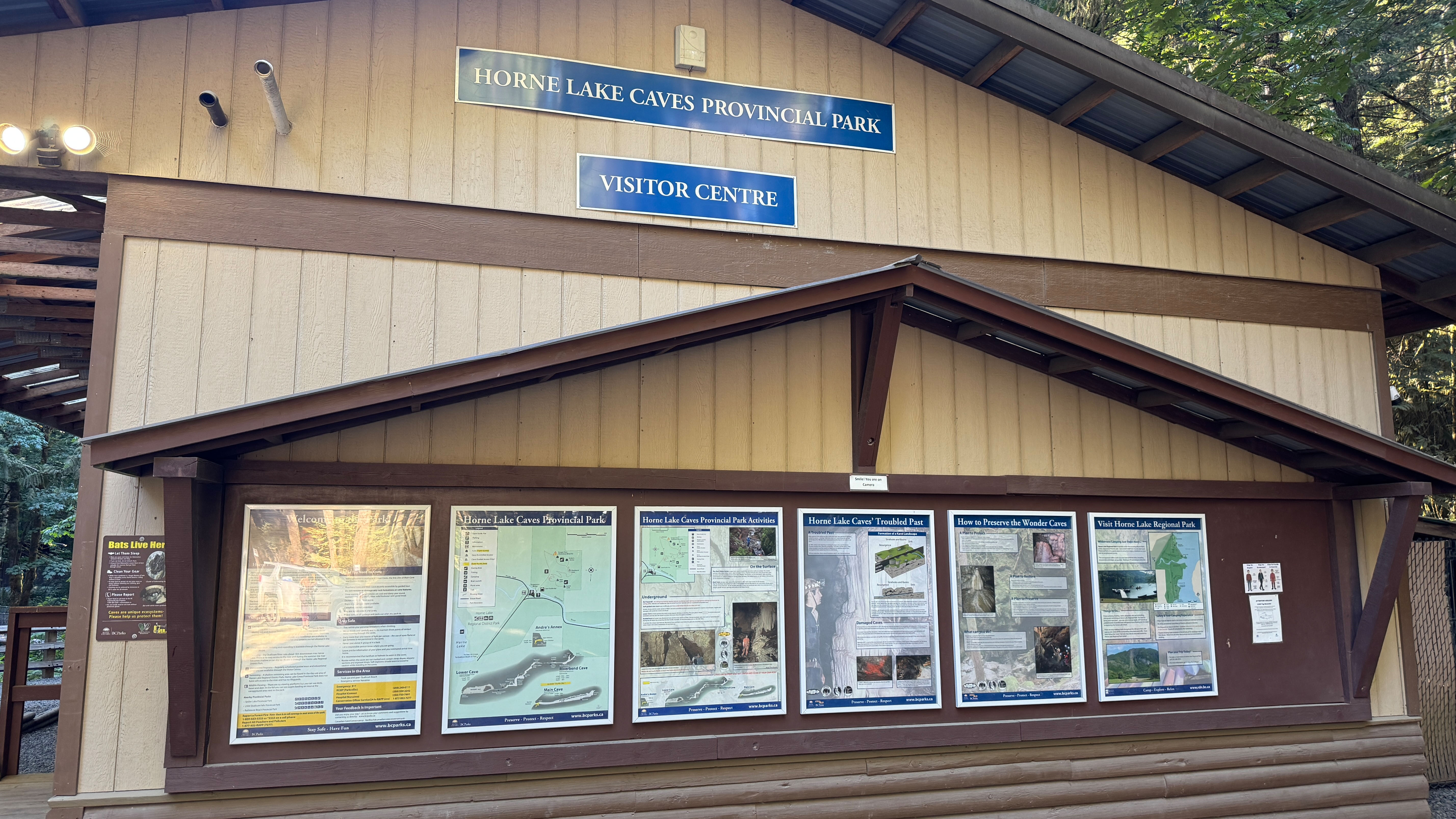
Horne Lake Caves Park Choose self-guided exploration of Andre's Annex Cave (54m passage, bring headlamp and helmet) or guided tours ranging from 90-minute Family Explorer to extreme 4-5.5 hour expeditions. Cave temperature remains 8°C year-round. Tours often sell out in summer - advance reservations essential
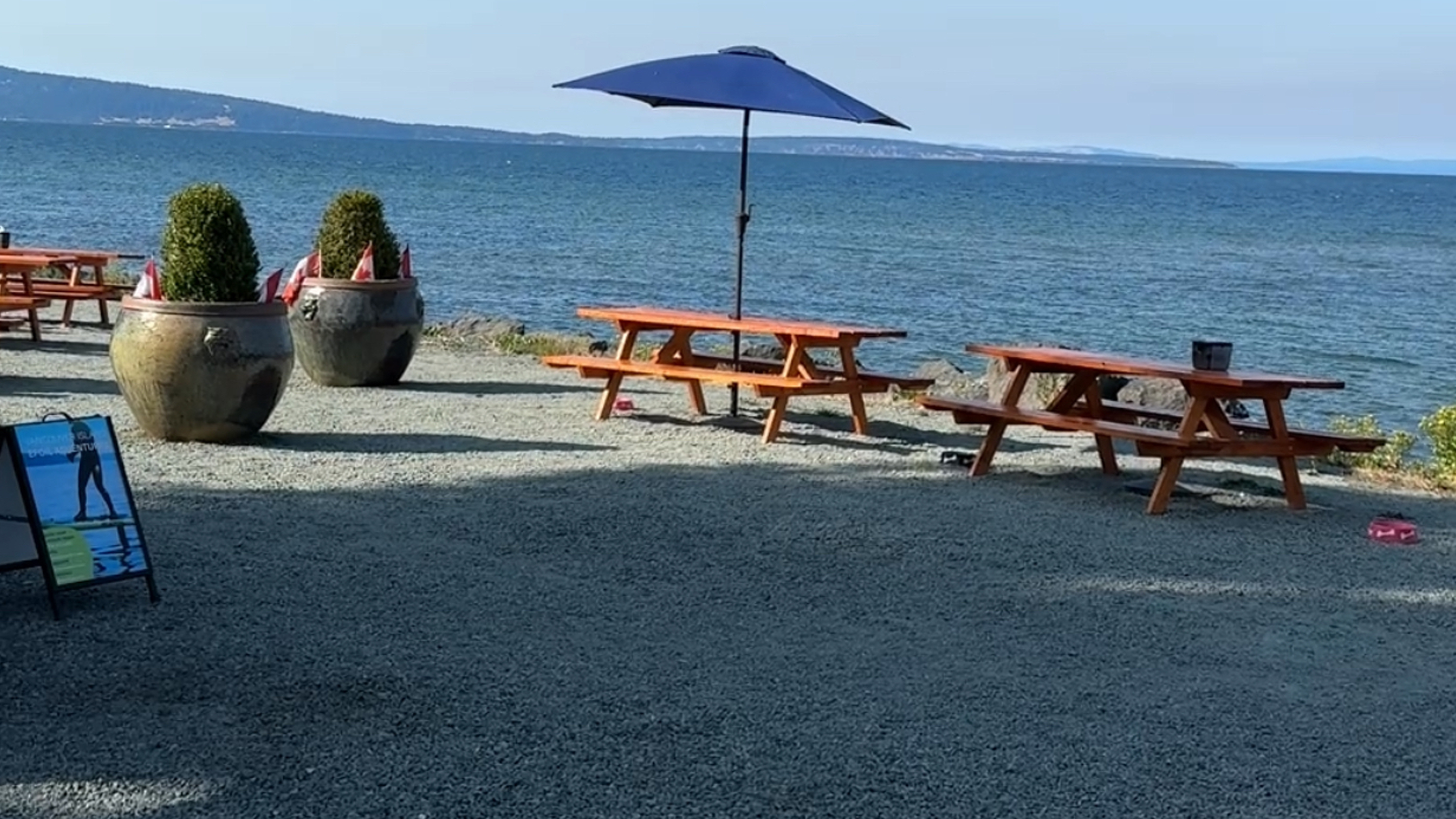
Road Trip Food Stop with the Best View
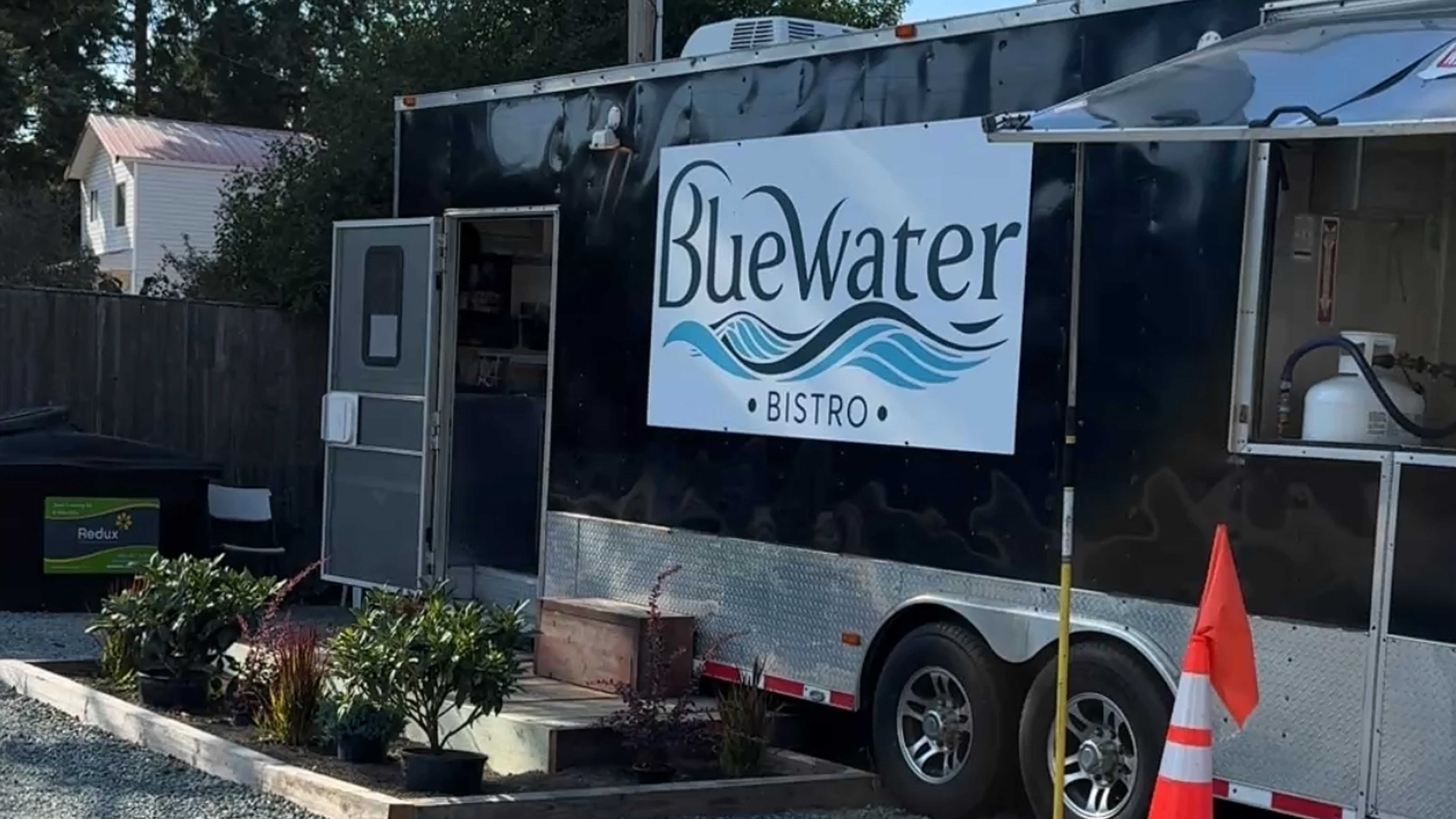
Blue Water Bistro (Qualicum Bay) Oceanfront bistro with food-truck style kitchen and patio seating. Fresh seafood focus including halibut tacos ($21), lobster bisque ($27), and house-made pastries. Daily 11:30am-7:30pm in summer. Perfect lunch stop during your waterfall tour.
Day 2: Exploring Campbell River Area
Distance: 2 km round trip | Elevation Gain: Minimal | Difficulty: Easy-Moderate
Ripple Rock Trail 8.0 km round-trip, 360m elevation gain, 2.5-3.5 hours. Moderate difficulty trail to Wilfred Point Lookout overlooking Seymour Narrows, site of the famous 1958 Ripple Rock explosion - Canada's largest non-nuclear blast that removed dangerous underwater peaks. Well-maintained forest path with interpretive signs. Trailhead 17 km north of Campbell River on Highway 19.
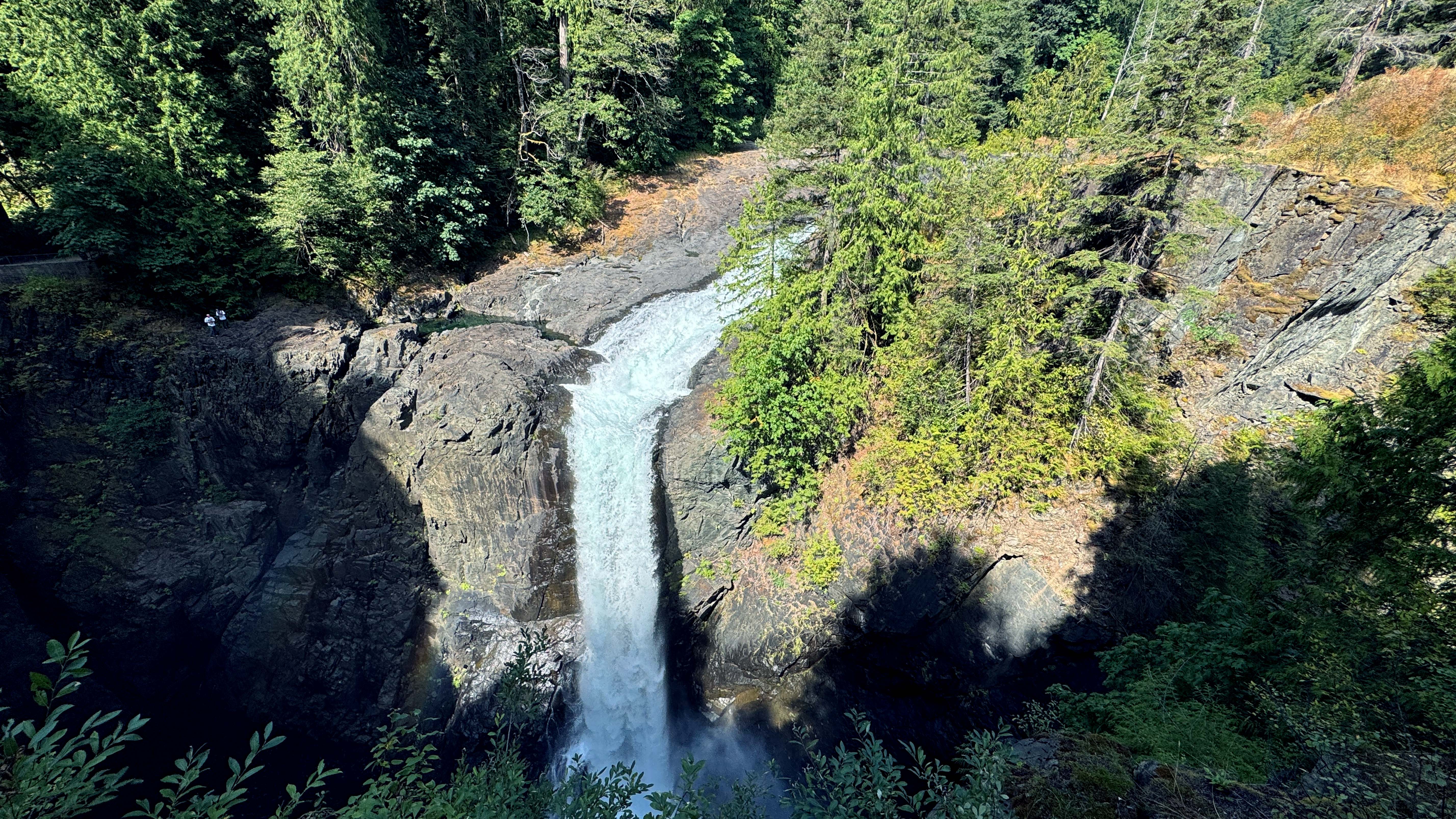
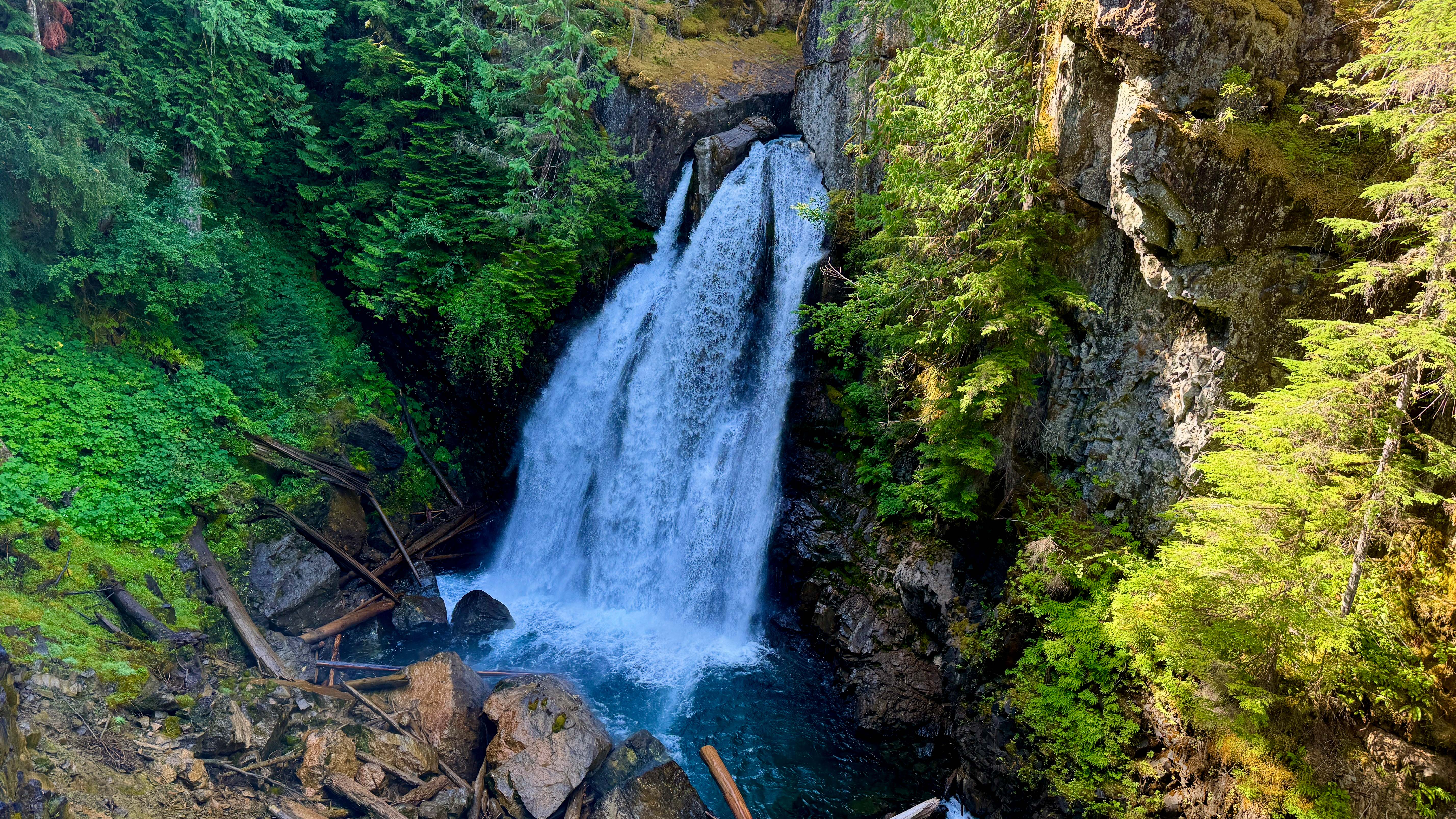
Elk Falls Provincial Park Suspension bridge strung 210 feet above plunging Elk Falls. Quick access to iconic bridge plus optional extended loop to Deer Falls through old-growth forest (add 1 hour). Photography challenging due to high wire sides - locals recommend using side platform for better angles.
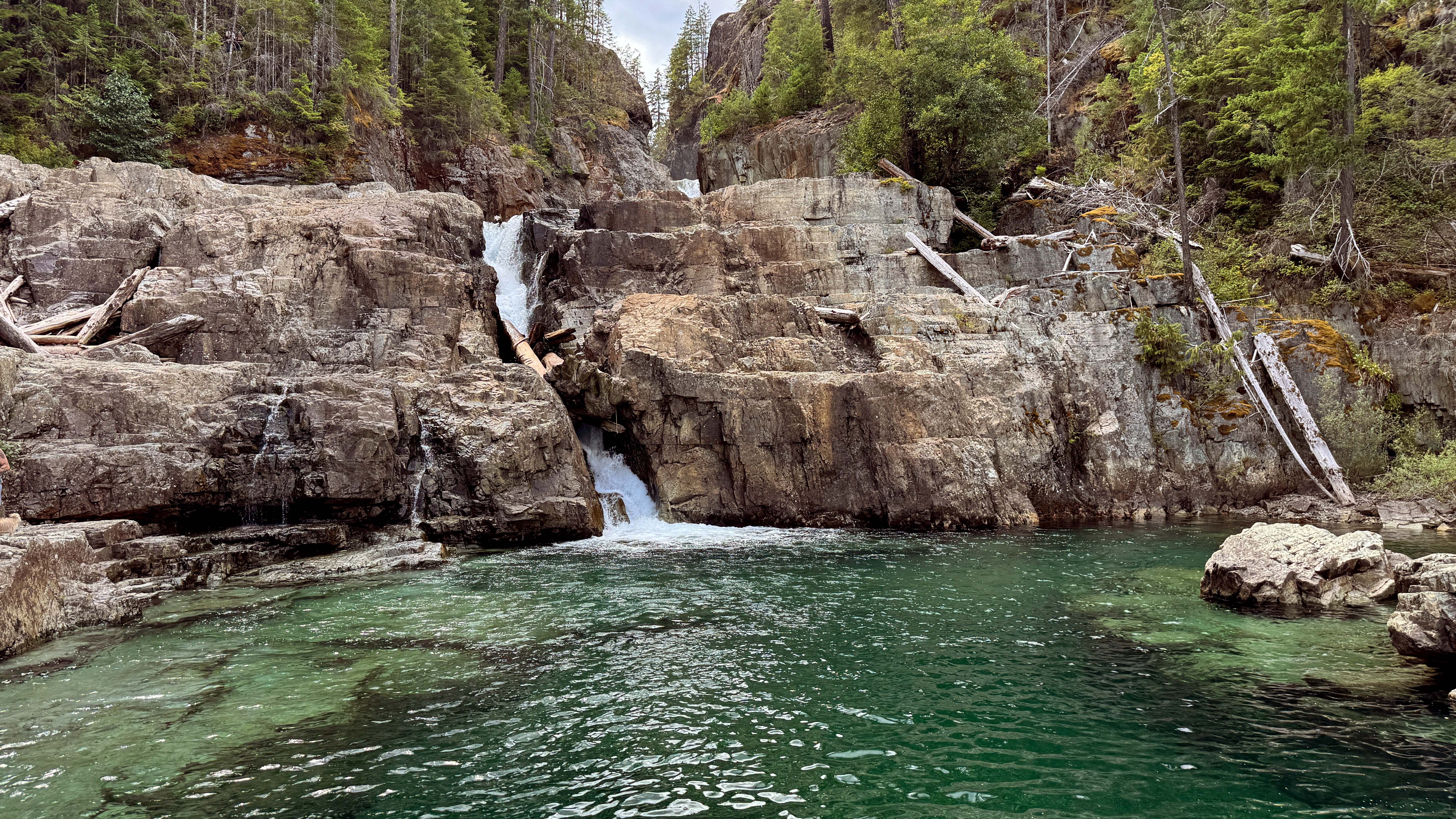
Lower Myra Falls (Strathcona Park) 1.0 km round-trip, 30-40 minutes. Multiple cascades flow through rock chutes into deep turquoise swimming pool. Crystal-clear water perfect for summer swimming when flow is lower and pools warmer. Stay in calm pool area and keep well back from rushing outflow to prevent being swept over next falls
Upper Myra Falls (Strathcona Park) 6 km round-trip, 2-3 hours. Longer forest walk to dramatic 23m cascade in granite amphitheater. More secluded than Lower Myra. Access requires driving past mine gate (when open) or adding extra walking distance if gate closed.
Lupin Falls (Strathcona Park) 0.8 km loop, 20 minutes. Easy walk through old-growth cedar/fir forest to two-tier cascade (40m tall) tumbling down mossy cliffs into clear pool. Access off Westmin Road, 19 km south of Highway 28 junction. Standalone loop but close to other Buttle Lake sites.
Campbell River Food Recommendations
- Freyja: Artisan coffee with exceptional croissants
- Fogg Duckers Coffee Shack: Quirky waterfront location
- Ideal Cafe: Classic breakfast comfort food
- Crabby Bob's Seafood (Discovery Pier) Fresh seafood market with take-away options including crab, prawns, oysters, depending on availability.
- Beach Fire Brewing Community craft brewery with wood-fired pizzas and share plates. Social hub with frequent live music on weekends.
- Fifty Parallel Tap & Grill Greek fusion and pub fare with ocean views. Steampunk-West Coast vibe with waterfront patio.
Day 3: Campbell River to Port Hardy
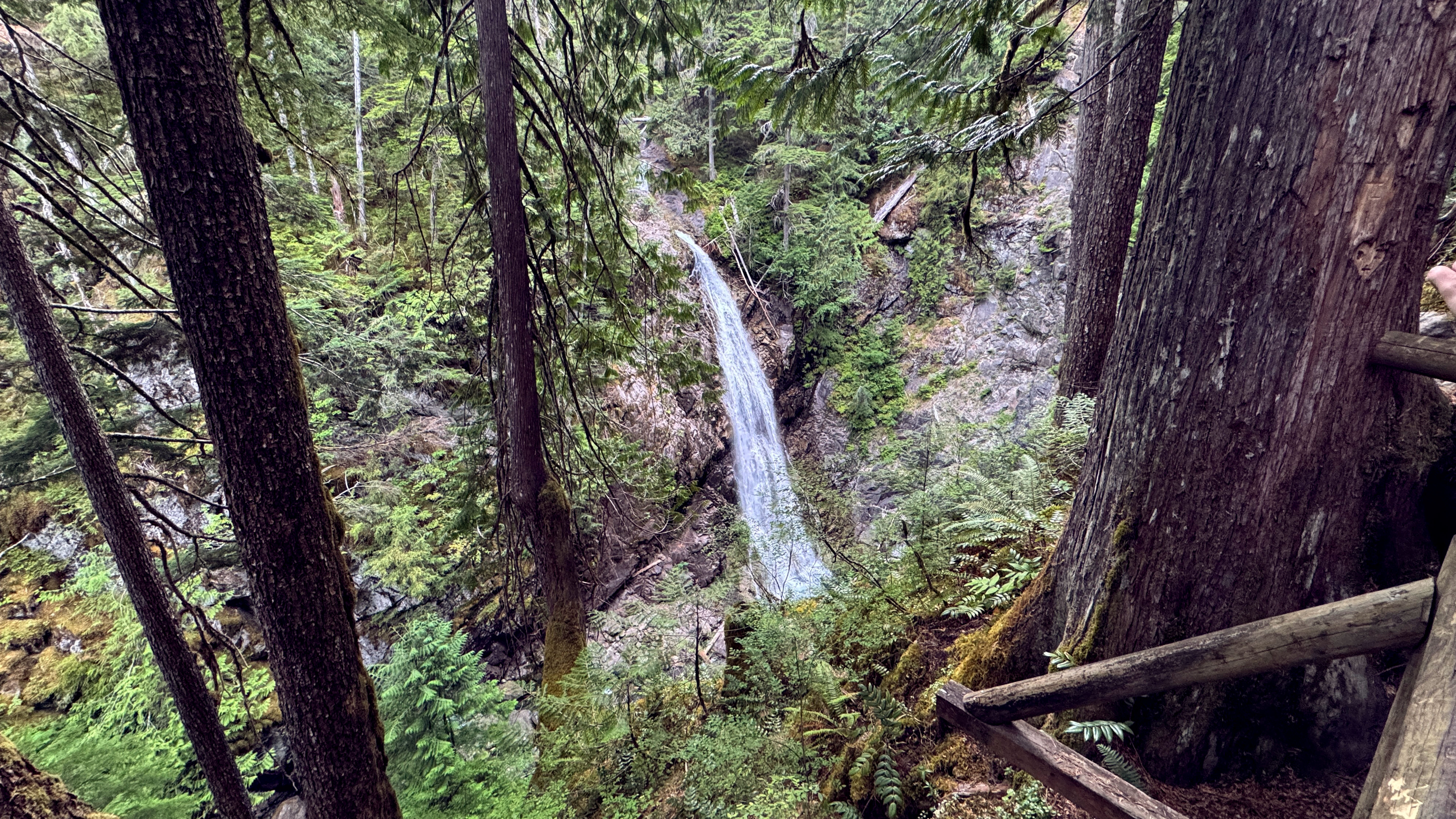
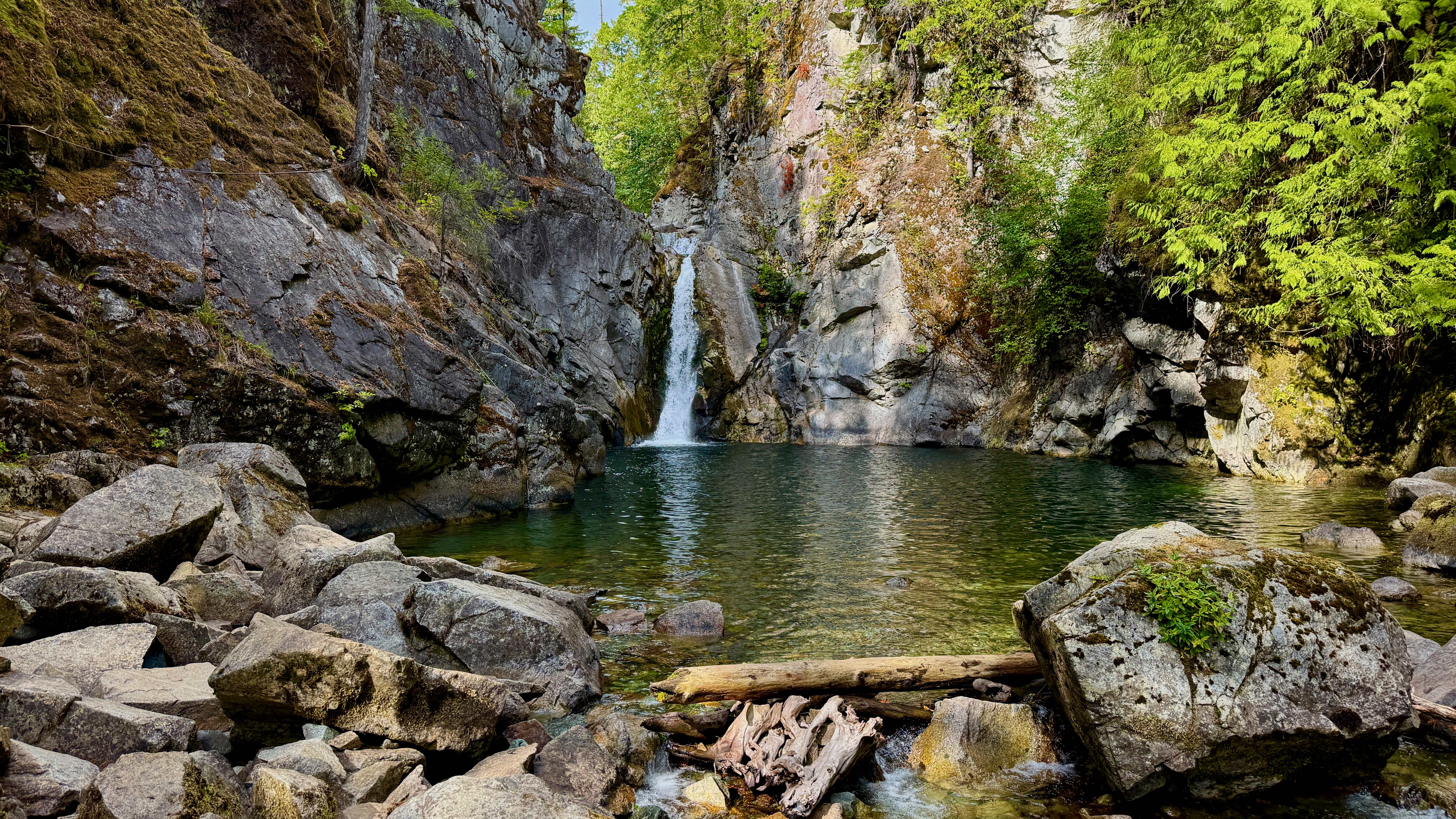
Lady Falls (Strathcona Park) 900m round-trip, 20 minutes, easy difficulty. Roadside waterfall featuring 30m plunge over cliff into rocky gorge. Fenced viewing deck overlooks falls. Best viewed in spring when it's a thundering torrent - you can feel spray at platform. Access off Highway 28 about 30 km west of Buttle Lake junction.
Cala Creek Falls (Gold River-Tahsis Road) Dramatic roadside cascade tumbling down Baldy Mountain in multiple streams. No formal trail - park on roadside shoulder when you see the cascade. During rainy season becomes "roaring wall of water audible from afar." Summer's lower flow allows careful exploration of rocky creek bed with exposed bedrock.
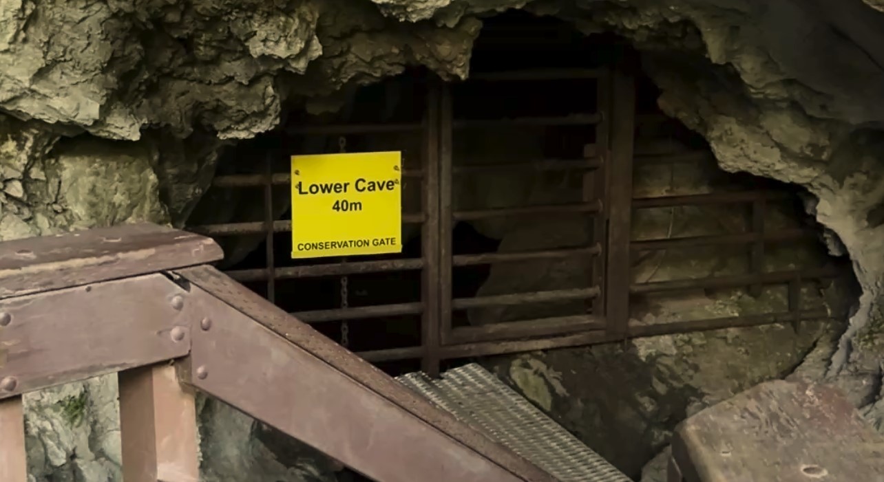
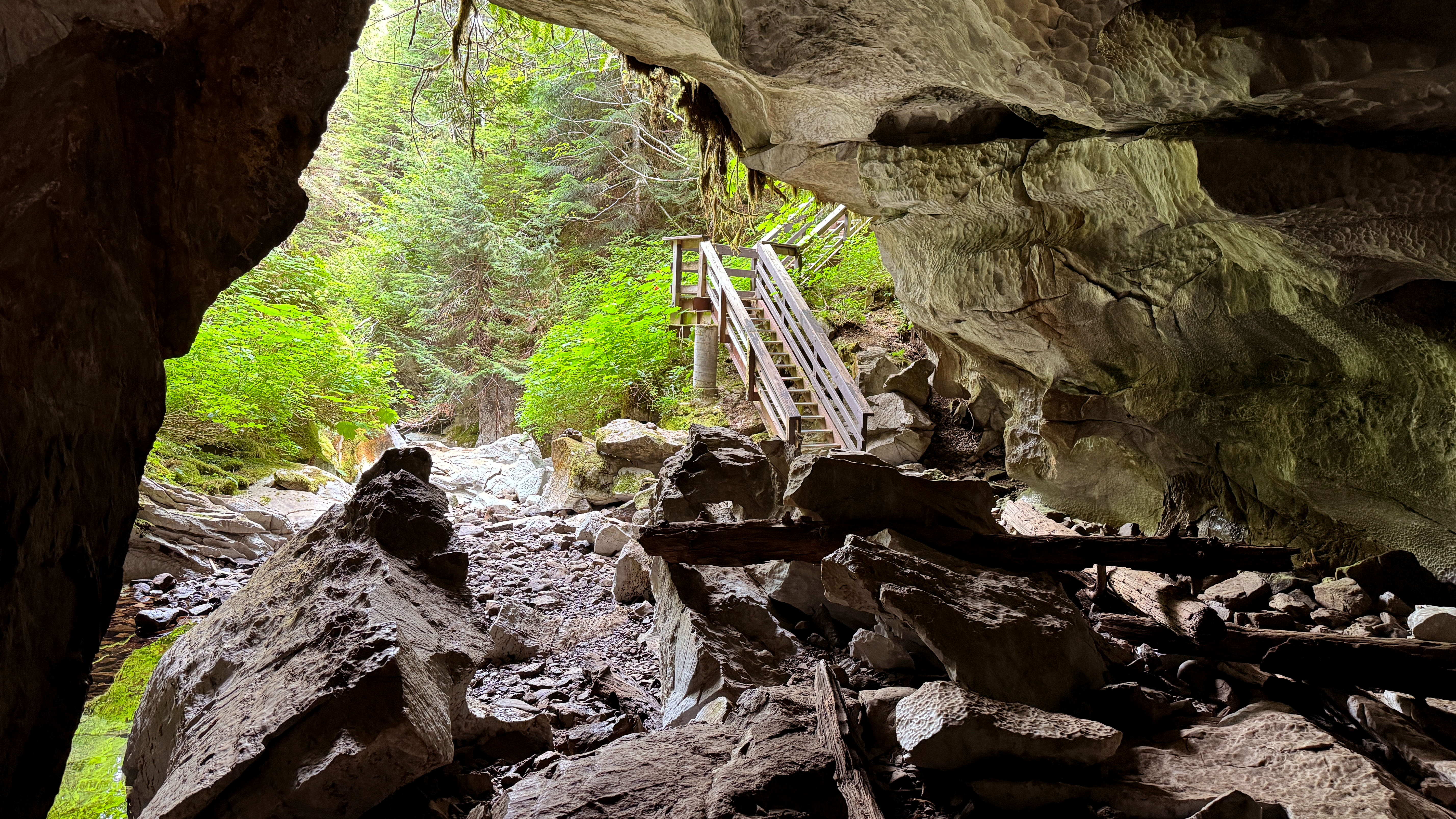
Upana Caves (Gold River) 1.5 km total trails, 1 hour exploration. Self-guided cave system with 15 entrances in limestone karst area. Features stalactites, flowstone, and underground creek (Upana River). "Resurgence Cave" and "Cathedral Cave" with large chamber are highlights. Equipment required: headlamps, helmets strongly advised, grippy shoes. Temperature inside remains 8°C year-round.
Telegraph Cove Boardwalk Village Historic boardwalk community - one of the last remaining on Vancouver Island. 2025 Status: December 2024 fire destroyed about one-third of boardwalk including Whale Interpretive Centre and Old Saltery Pub. Resort remains open with accommodations and wildlife tours operating from temporary facilities. Whale watching and grizzly bear tours continue departing regularly during May-October season.
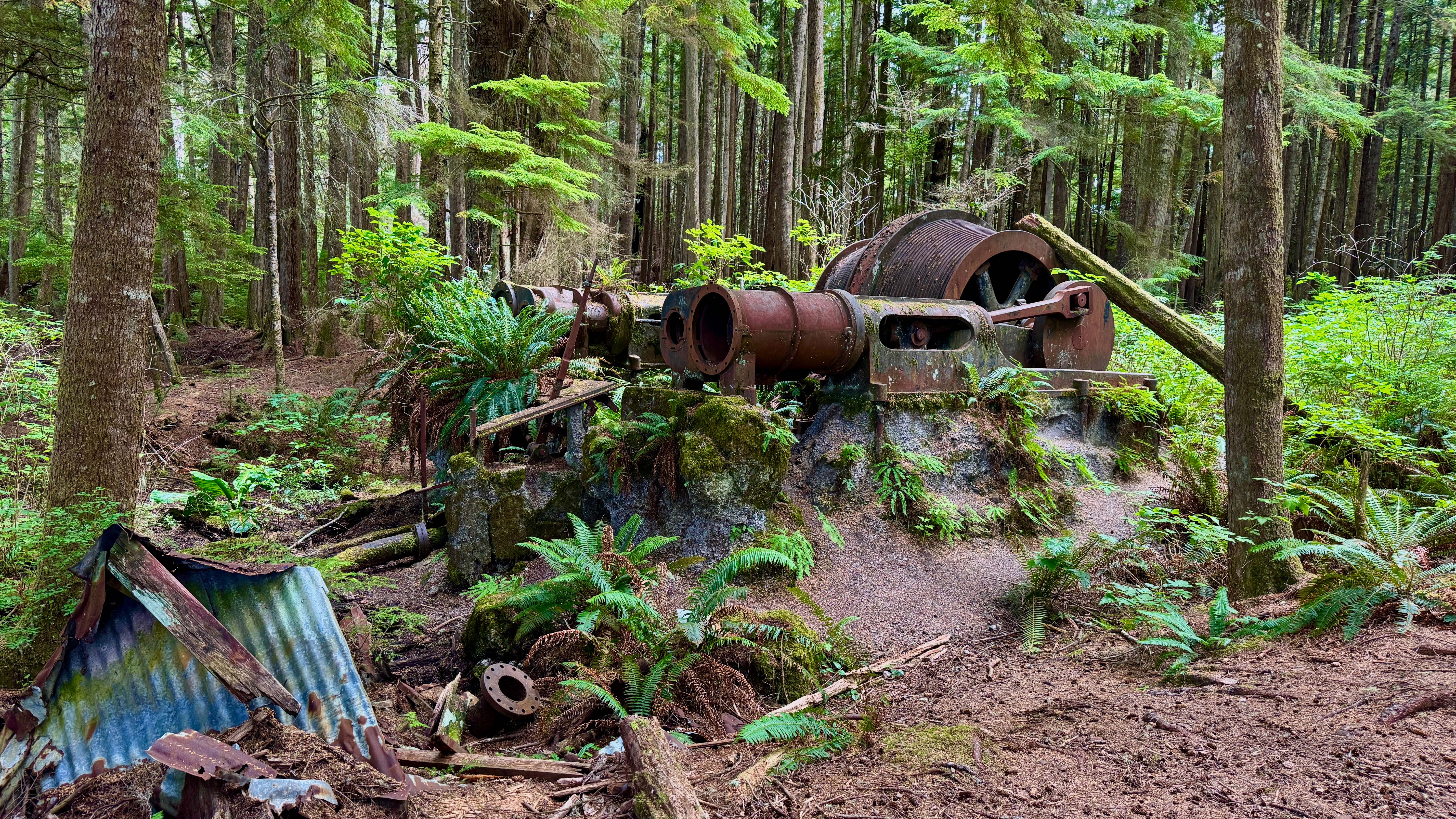
Suquash Mine Trail 4-5 km round-trip, easy grade following old roadway. Hike to remnants of BC's first coal mine (1840s-1920s) including stone fireplaces, rusted mining equipment, and dock pilings on the beach. Trail gently downhill to coast following former rail bed. Access via Coal Harbour Road to gravel logging roads - regular cars manageable in dry conditions.
Port Hardy Food Recommendations
Nax'id Pub: Indigenous-inspired west coast cuisine. Fresh seafood chowder, fish tacos, bison burgers. Serves both breakfast and dinner. Known as the breakfast spot in Port Hardy.
Tandoori Junction 2: Family-owned restaurant serving aromatic curries, tandoori specialties, and flavorful Indian comfort food.
Day 4: San Josef Bay Expedition
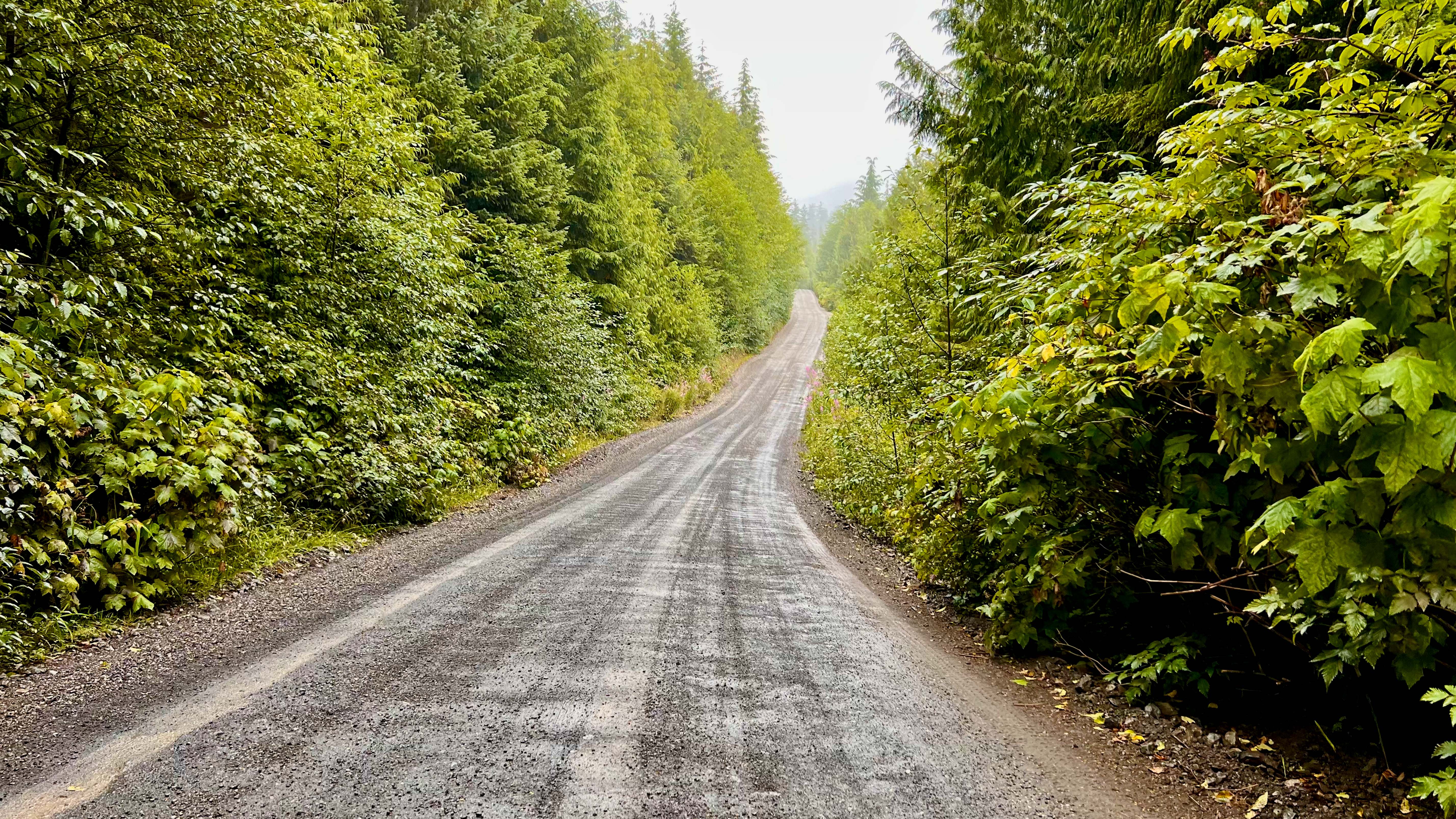
Logging Road Journey to Cape Scott 1.5-2 hour drive on rough gravel roads from Port Hardy. Holberg Road (49 km): washboard sections with sharp "shot-rock" gravel causing frequent flat tires. San Josef Main (18 km): generally better condition but expect significant potholes and dust clouds. Drive slowly under 40 km/h and carry good spare tire. No services or cell coverage on entire route. Check this resource for the latest road conditions.
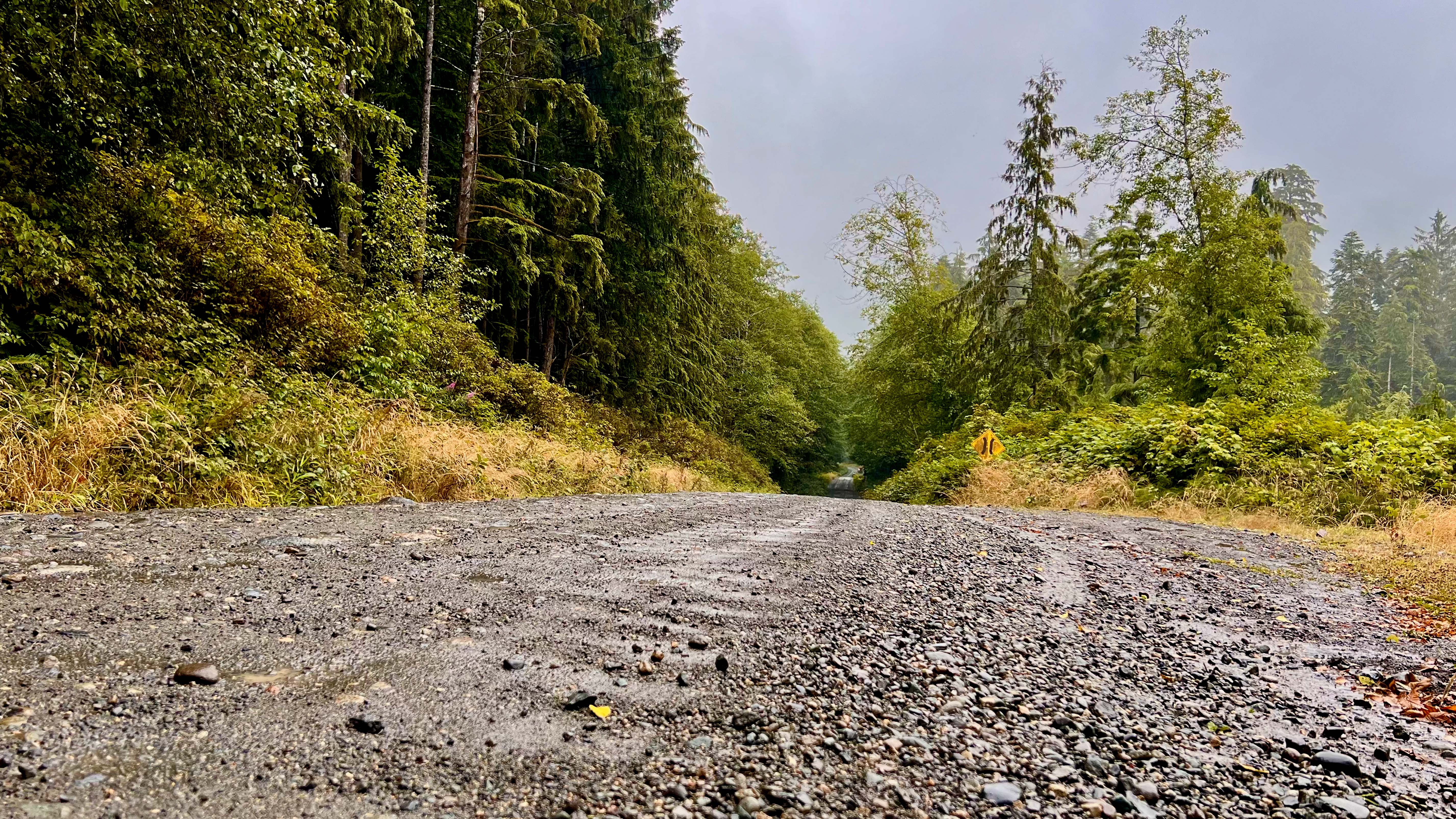
Scarlet Ibis Pub (Holberg) Vancouver Island's most remote pub in tiny logging hamlet (population ~35). Essential stop for meal and leg stretch. Summer hours: Mon-Tue 3-8pm, Wed-Fri 1-8pm, Sat-Sun 11am-8pm (kitchen closes 7:30pm). Fresh fish & chips, burgers, pizzas, and local craft beer. Only restaurant in the area.
Shoe Tree (Kains Lake) Quirky roadside photo opportunity 1 km beyond Holberg. Cedar snag covered in hundreds of old shoes left by hikers over the years. Quick stop for memorable photos.
San Josef Bay Trail 2.5 km one-way, 45 minutes, easy flat gravel trail through lush forest and marsh. San Josef Bay delivers a truly wild Pacific Northwest experience - expansive white sand beaches stretching for kilometers with virtually no development in sight. The dramatic sea stacks create natural sculptures rising from the sand, while hidden sea caves invite exploration during low tide. On clear days, you might spot whales offshore, and the complete absence of cell towers and buildings creates an almost otherworldly sense of remoteness. Often called "most beautiful beach on Vancouver Island" with pristine white sand and towering rock formations. Plan arrival for low tide to access sea caves and second beach area, check the tide charts for the best arrival times
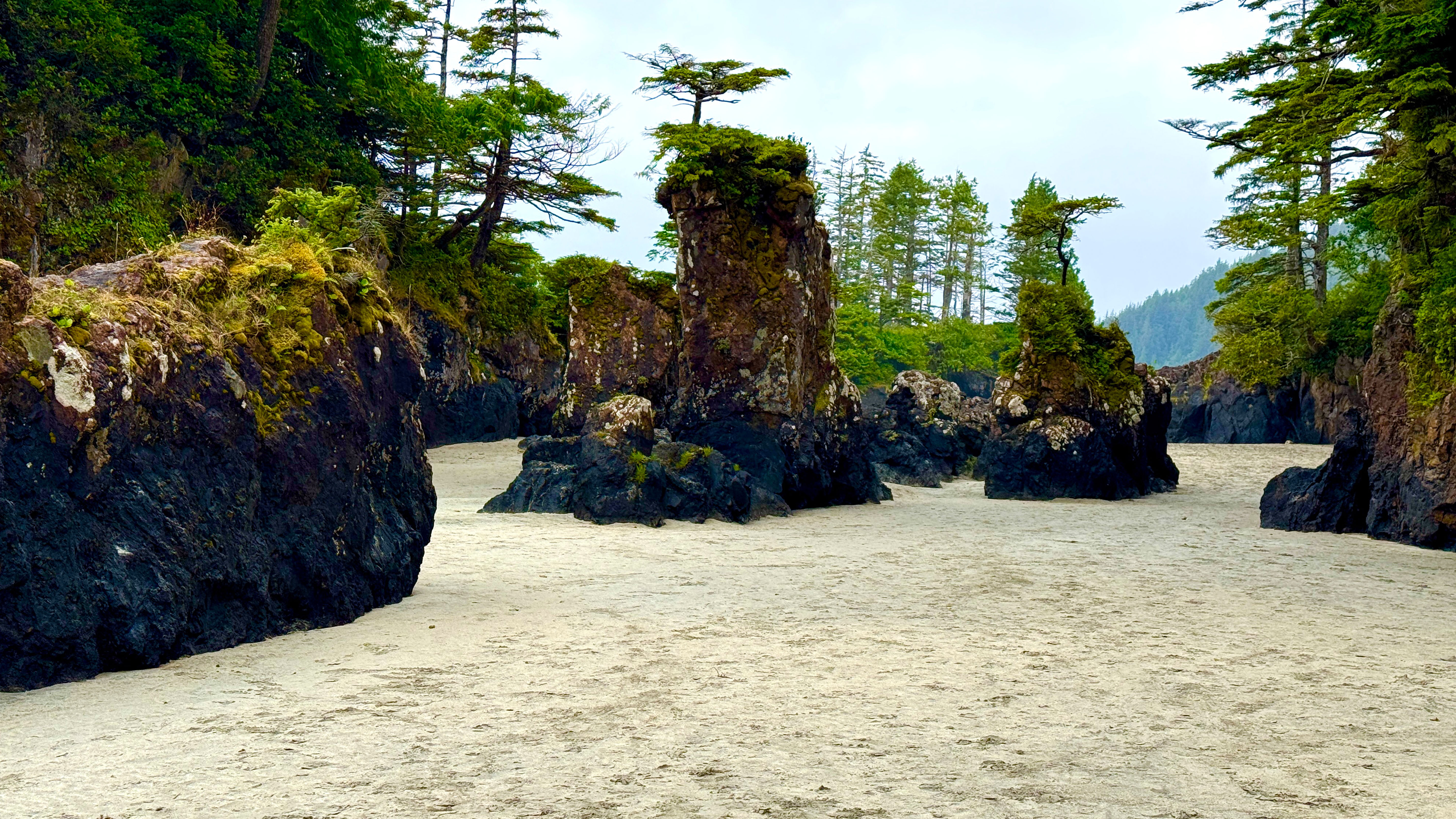
Camping at San Josef Bay Backcountry camping is permitted directly on the beach above the high-tide line. Free camping with pit toilet facilities in the forest edge and bear-proof food cache bins provided. No reservations required but arrive early in summer as prime beach spots fill up.
Day 5: Return Journey
Oyster River Potholes (Lower) 300m walk from parking, easy difficulty. Oyster River has carved deep, circular pools and smooth chutes in bedrock creating natural "pothole" tubs perfect for summer swimming. Crystal-clear turquoise water warms nicely by July/August when flow is low and safe. Access via York Road - park respectfully without blocking driveways and pack out all garbage.
Hole-in-the-Wall 2.0 km round-trip, easy difficulty. Man-made circular hole (~2m diameter) blasted through rock in 1960s for water pipeline. Rogers Creek now flows through creating photogenic "waterfall pouring out of cliff" effect. Access via small pullout on Highway 4 across from Coombs Country Candy. Morning light beams through hole beautifully on clear days.
China Creek Falls (Port Alberni) 2.7 km round-trip, 50m elevation descent, moderate difficulty. Two-tier waterfall (15-20m total) plunging into large swimming hole. Trail includes rope-assisted downclimb near end, but crystal-clear pool makes it worthwhile for summer swimming. Access via Franklin River Road off Highway 4, ~2 km to small trailhead pullout. Best photography during mid-afternoon light (2-4pm) when sun filters into north-facing falls.
Frequently Asked Questions
What vehicle do I need for this trip?
Most destinations accessible by regular cars, but San Josef Bay requires 65 km of rough logging roads with sharp gravel causing frequent flat tires. Essential items: spare tire in good condition, tire repair kit, portable air compressor. High clearance recommended but not required for Cape Scott access.
Car Rentals for San Josef Bay: If you need a rental vehicle specifically for the Cape Scott expedition, car rentals are available in Port Hardy. Critical: Reserve well in advance and request a truck with reinforced tires - only trucks with proper tire reinforcement are typically insured for logging road use, not standard SUVs. Always call the rental agency ahead of your trip to confirm the specific vehicle can be taken on logging roads to Cape Scott, as policies vary and some agencies may restrict access entirely.
Is there cell phone service?
Zero cell service from 20 km outside Campbell River until reaching Port McNeill/Port Hardy communities - approximately 200 km with no coverage. Download offline maps and inform someone of your detailed itinerary before departing.
What should I pack?
Vehicle emergency kit, bear spray, headlamp with extra batteries, waterproof layers, sturdy hiking boots, swimwear for potholes and beaches, waterproof camera protection, extra food and water for remote areas.
Additional Sources:
Stewart Tourism Auto Tour PDF
Signature Experiences: Salmon Glacier


