6 Best Alpine Lake Hikes Around Vancouver: Discover BC's Hidden Mountain Gems
Easy to Moderate Trails with Spectacular Views
While Joffre Lakes and Garibaldi Lake draw massive crowds and require advance reservations, Vancouver's backyard offers spectacular alpine lake alternatives that deliver equally stunning experiences without the masses. These six extraordinary destinations span multiple mountain ranges, each offering unique rewards from convenient highway stops to remote wilderness adventures.
What makes alpine lake hiking around Vancouver special isn't just the stunning turquoise waters or dramatic mountain backdrops, it's the incredible variety of experiences available within a few hours' drive. Whether you're seeking a peaceful family outing, a challenging day hike, or a serious wilderness expedition, these carefully selected lakes showcase the best of what BC's Coast Mountains and Cascades have to offer beyond the overcrowded classics
Quick Comparison: Vancouver's Top 6 Alpine Lakes
Falls Lake
- Distance from Vancouver: 3 hours (180 km)
- Round-Trip Distance: 2 km
- Difficulty: Easy
- Elevation Gain: 50-60 m
- Best Season: May-October
- Permits: None required
- Highlights: Highway accessible, emerald waters, family-friendly, primitive camping
Lindeman Lake
- Distance from Vancouver: 2 hours (130 km)
- Round-Trip Distance: 3.4 km
- Difficulty: Moderate
- Elevation Gain: 200-300 m
- Best Season: April-October
- Permits: Camping only ($5/person/night)
- Highlights: Brilliant turquoise color, rocky scramble sections, popular day hike
Elfin Lakes
- Distance from Vancouver: 1h 45m (85 km)
- Round-Trip Distance: 22 km
- Difficulty: Long Moderate
- Elevation Gain: 600 m
- Best Season: June-October
- Permits: Day-use passes required Jun-Oct (Fri-Mon), camping reservations required
- Highlights: Alpine hut accommodation, 360° mountain views
Rohr Lake
- Distance from Vancouver: 3 hours (180 km)
- Round-Trip Distance: 10 km
- Difficulty: Difficult
- Elevation Gain: 530 m
- Best Season: July-September
- Permits: None required
- Highlights: Pristine wilderness, technical scrambling, exceptional solitude
Eaton Lake
- Distance from Vancouver: 1h 30m (150 km)
- Round-Trip Distance: 8.7 km
- Difficulty: Difficult
- Elevation Gain: 962 m
- Best Season: July-September
- Permits: None required
- Highlights: Ancient rainforest, dramatic waterfall, mirror-like reflections
Hanging Lake
- Distance from Vancouver: 2.5 hours (140 km)
- Round-Trip Distance: 20 km
- Difficulty: Expert Only
- Elevation Gain: 1,200 m
- Best Season: August-September
- Permits: None required
Falls Lake: Emerald Waters Steps from Highway
Distance: 7.5 km one-way | Elevation Gain: 918 meters | Difficulty: Moderate
Tucked away at Coquihalla Summit, Falls Lake proves you don't need to hike for hours to reach genuine alpine beauty. Just 1 km off Highway 5 at Exit 221, this emerald gem sits surrounded by granite peaks, offering an authentic mountain lake experience in under 30 minutes of walking.
The gentle trail through conifer forest leads to a striking green lake, where the water's color comes from fine glacial sediments and forest reflections. Small rainbow trout inhabit the clear waters, and two tent pads offer free backcountry camping for those wanting an easy overnight mountain experience.
Between towering Nak Peak and Zoa Peak, the lake showcases the transition between coastal and interior ecosystems.Winter transforms Falls Lake into a popular snowshoe destination, while summer brings wildflower blooms and autumn delivers spectacular colors by late September.
The lake's outhouse and designated camping spots make it ideal for families or anyone seeking alpine beauty without the commitment of longer hikes.
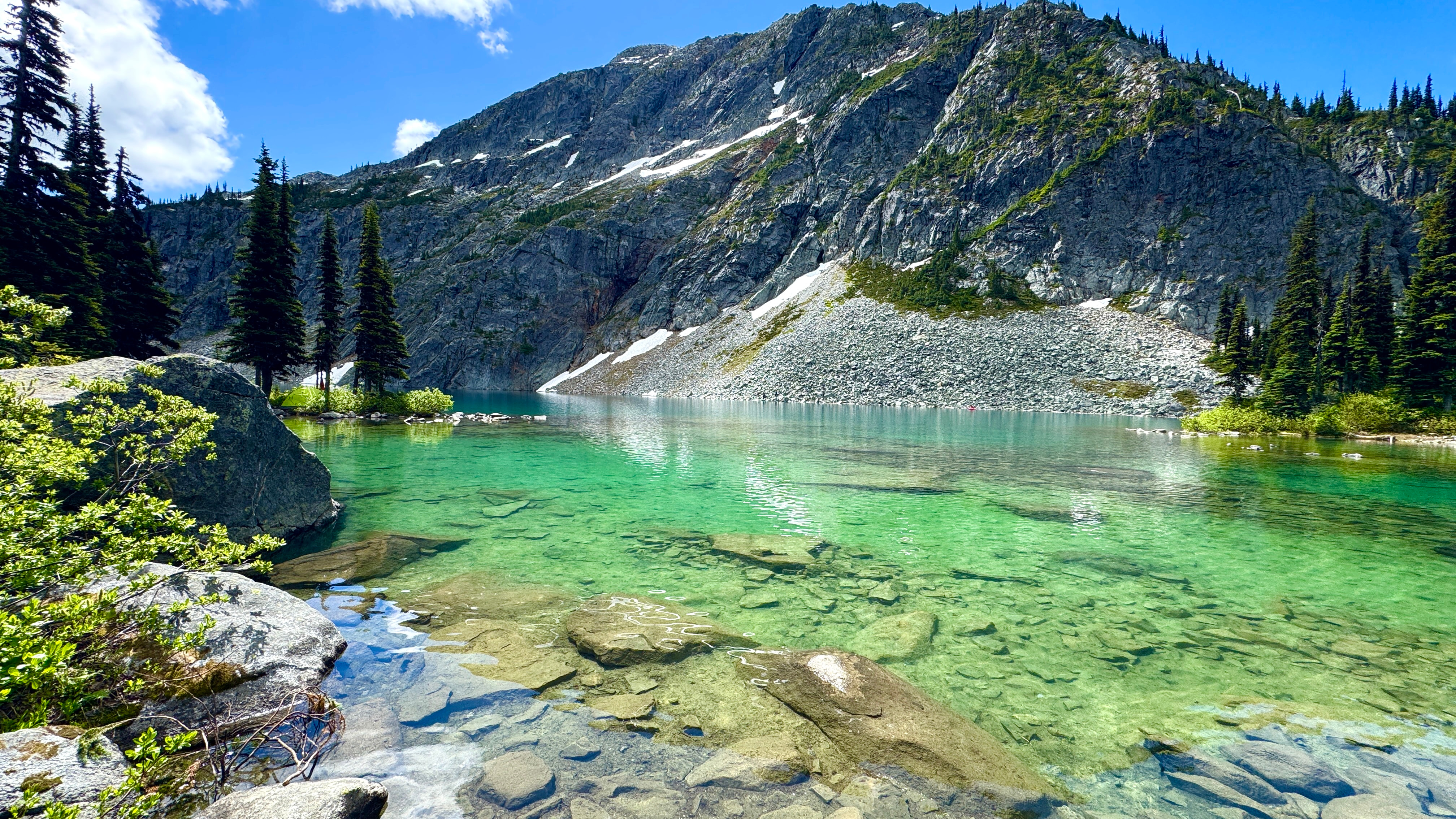
Lindeman Lake: Brilliant Turquoise and Moss-Covered Boulders
Distance: 2 km round trip | Elevation Gain: Minimal | Difficulty: Easy-Moderate
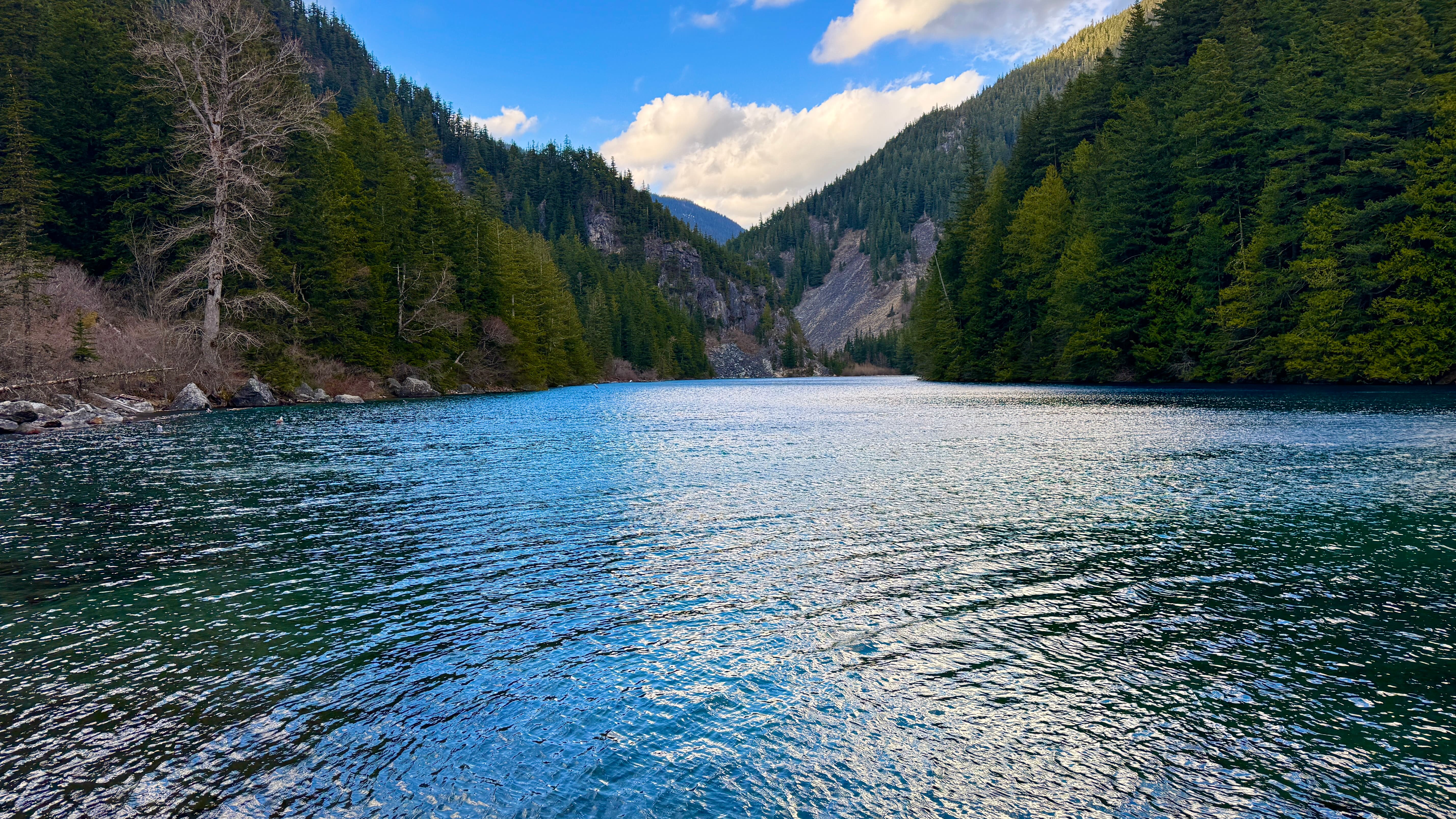
Lindeman Lake delivers one of BC's most spectacular color displays in a compact hiking package. The brilliant turquoise water rivals famous destinations but offers a more intimate experience in Chilliwack Lake Provincial Park, where suspended glacial flour creates the stunning hue that photographers dream about.
The trail wastes no time challenging hikers with a steep, rocky ascent alongside Post Creek. After crossing a sturdy metal bridge at 0.5 km, you'll navigate a forest path with jumbled maze of house-sized rocks.
The lake's exceptional clarity often reveals small trout swimming in the shallows, while the 12°C summer temperatures attract brave swimmers on hot days. The combination of forest hiking and rock scrambling makes this an excellent introduction to more challenging alpine adventures. Designated backcountry camping with tent pads, outhouse, and bear hang infrastructure makes overnight stays comfortable, with black bears actively using the valley during berry season.
Elfin Lakes: Twin Lakes and Mountain Hut
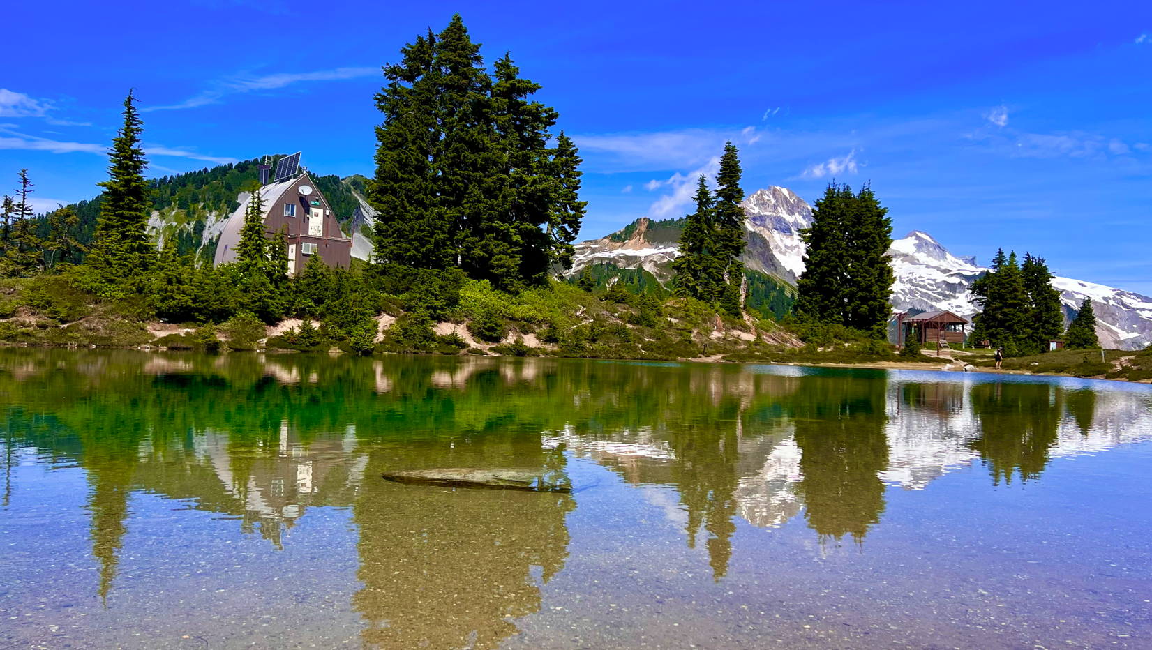
Elfin Lakes represents Garibaldi Provincial Park's most accessible alpine destination, where the challenge of 22 km distance meets exceptional mountain infrastructure. The route follows an old lodge road through ancient coastal forest before emerging onto Paul Ridge: a spectacular 4 km alpine traverse with unobstructed views of Mount Garibaldi's glaciated summit, the vast Mamquam Icefield, and distant peaks stretching to Vancouver Island.
The destination's unique two-lake system designates one for swimming (surprisingly comfortable by alpine standards) and another for drinking water supply. The nearby 33-person Elfin Lakes Hut adds rare social elements to the wilderness experience, providing propane burners, bunks, and winter heating that makes this popular for both summer hiking and winter ski touring
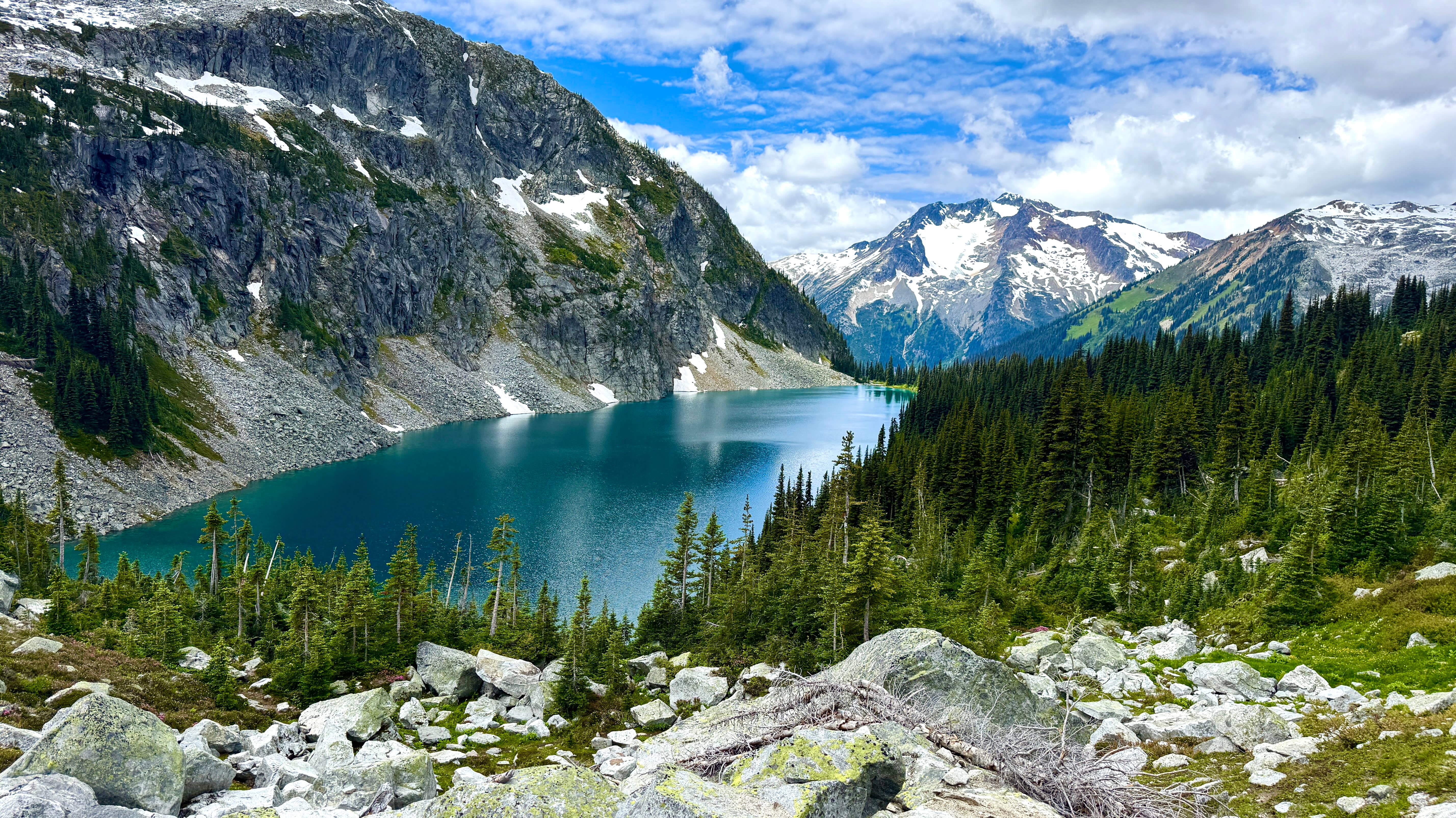
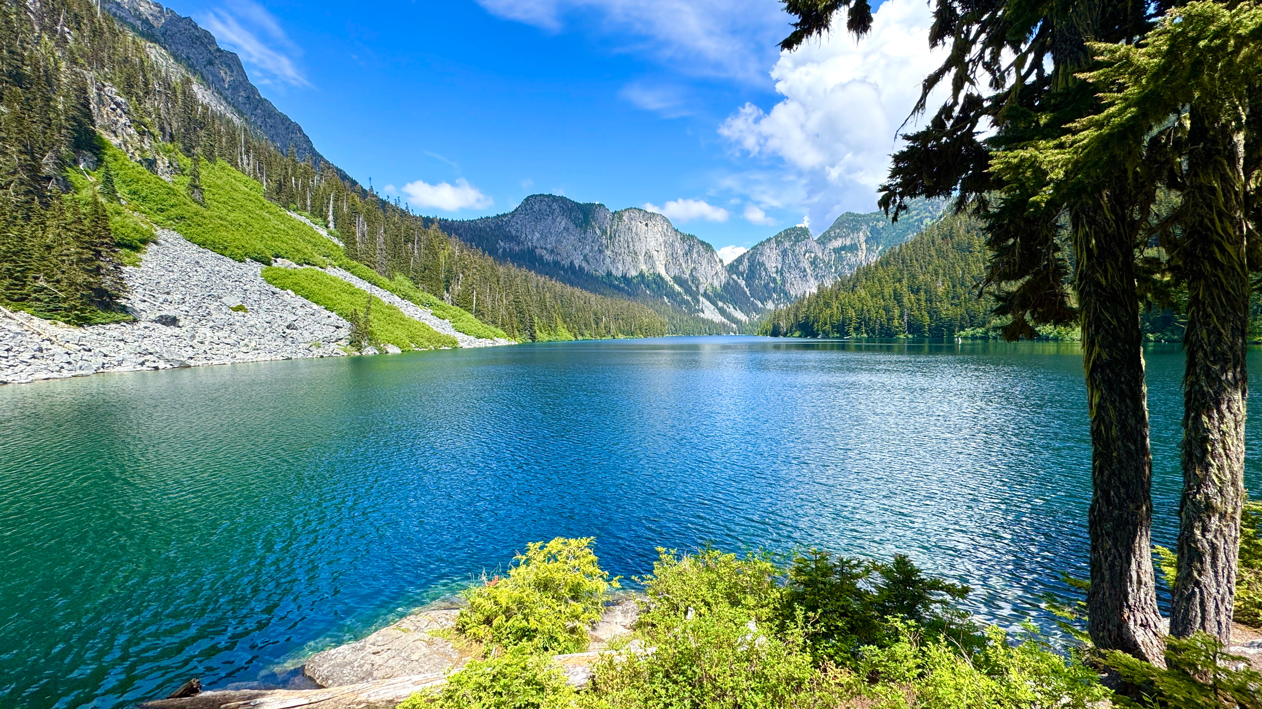
Rohr Lake: Wilderness Solitude Across from Joffre
Distance: 6 km round trip | Elevation Gain: 350 meters | Difficulty: Moderate
Located across the highway from busy Joffre Lakes, Rohr Lake rewards hikers with one of the most pristine alpine experiences near Vancouver. While Joffre sees hundreds of visitors daily, this hidden gem might host a dozen people on busy summer days, creating the wilderness solitude that's increasingly rare in southwestern BC.
The unmaintained route includes: navigation through muddy bogs, technical boulder field scrambling, and careful route-finding across alpine meadows where orange flagging helps guide the way. The final part involves a steep scramble up loose boulders and mud with water often trickling down the "trail," requiring route-finding skills and comfort with exposed terrain.
Rohr Lake occupies a dramatic cirque with Mount Rohr's north face rising 600 m directly from the water. The exceptional clarity and teal color rival any alpine lake in BC. Free backcountry camping exists on informal sites near the southwest shore, though no facilities mean packing out everything and practicing strict Leave No Trace principles. GPS tracks or map and compass skills are essential since no cell service exists anywhere on the route.
The story of the Sigurd Trail
Crooked Falls is accessed via the Sigurd Trail, named in honor of Sigurd Hall, a Norwegian-Canadian mountaineer who tragically died in 1940 during a skiing accident. The trail takes hikers through genuine old-growth forest that includes trees estimated to be over 500 years old, offering a glimpse into what coastal BC looked like before extensive logging.
The Sigurd Creek watershed supports diverse wildlife, including black bears and mountain goats that occasionally can be spotted on the surrounding slopes. The falls themselves drop approximately 30 meters in a series of dramatic cascades, creating a thunderous display during the April-June spring runoff when snowmelt from the mountains above feeds the creek to capacity. The unique bent shape of the falls as they navigate around a rocky outcrop gives them their distinctive "crooked" name and creates multiple vantage points for photographers.
Eaton Lake: Thundering Waterfall and Perfect Reflections
Distance: 5 km round trip | Elevation Gain: 150 meters | Difficulty: Easy
Eaton Lake delivers one of the most dramatic alpine experiences in the Canadian Cascades, where a relentless 962 m climb through ancient coastal rainforest rewards hikers with spectacular mountain reflections. Beginning at Eaton Creek Recreation Site near Hope, this demanding trail launches immediately into unforgiving terrain that tests endurance at every turn.
The route follows Eaton Creek's course with multiple challenging crossings through old-growth forest that provides its own rewards before reaching the alpine zone. Halfway through the ascent, a powerful waterfall offers both rest stop and spectacular photo opportunity before the final push to reveal Eaton Lake's mirror still waters.
At the destination, pristine alpine setting showcases why Eaton Lake ranks among the Canadian Cascades' most coveted destinations. The dramatic backdrop of Eaton Peak and Mount Grant creates some of the most striking reflection photography opportunities in southwestern BC, while the challenging terrain keeps crowds minimal despite the lake's proximity to Vancouver.
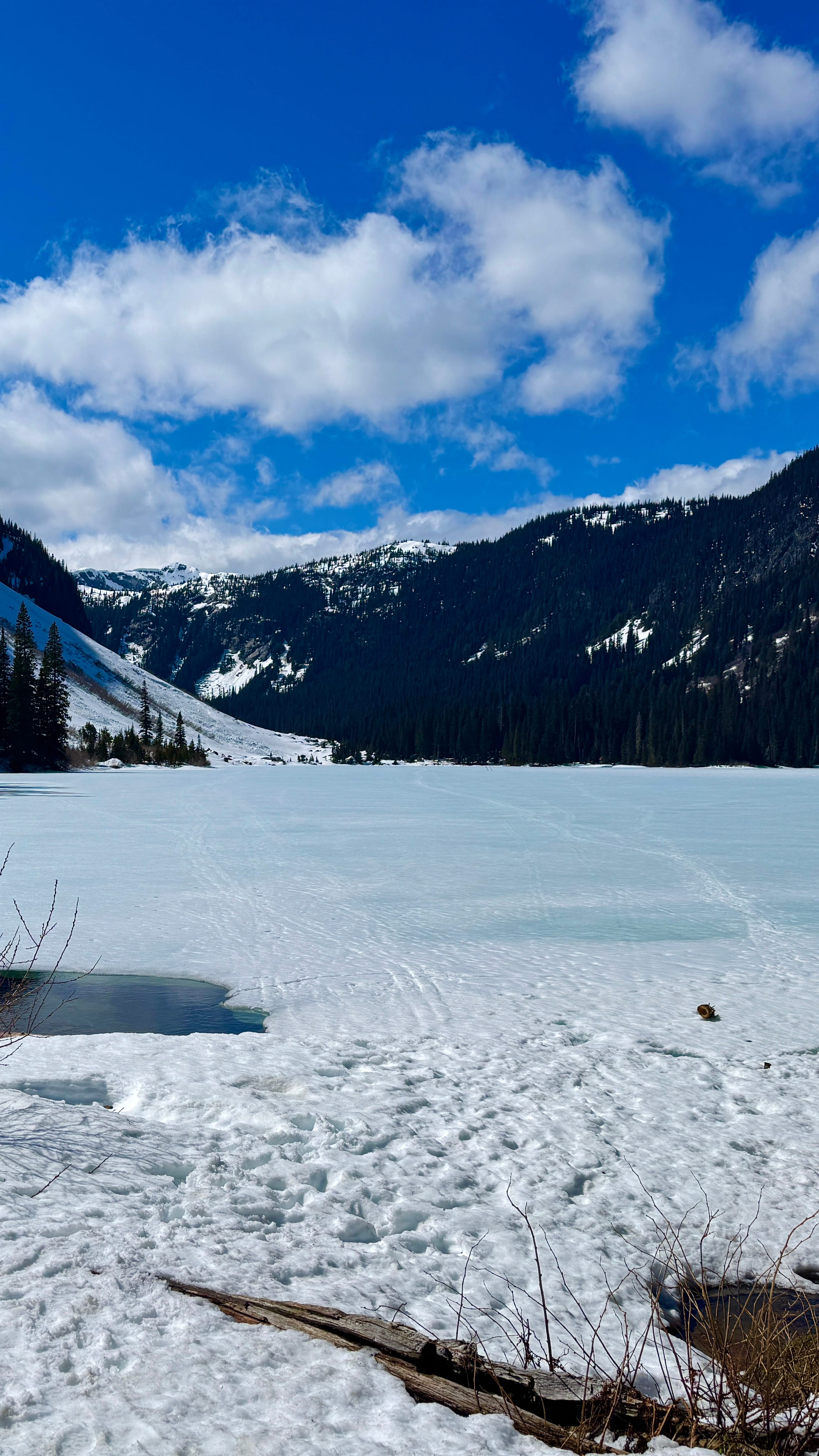
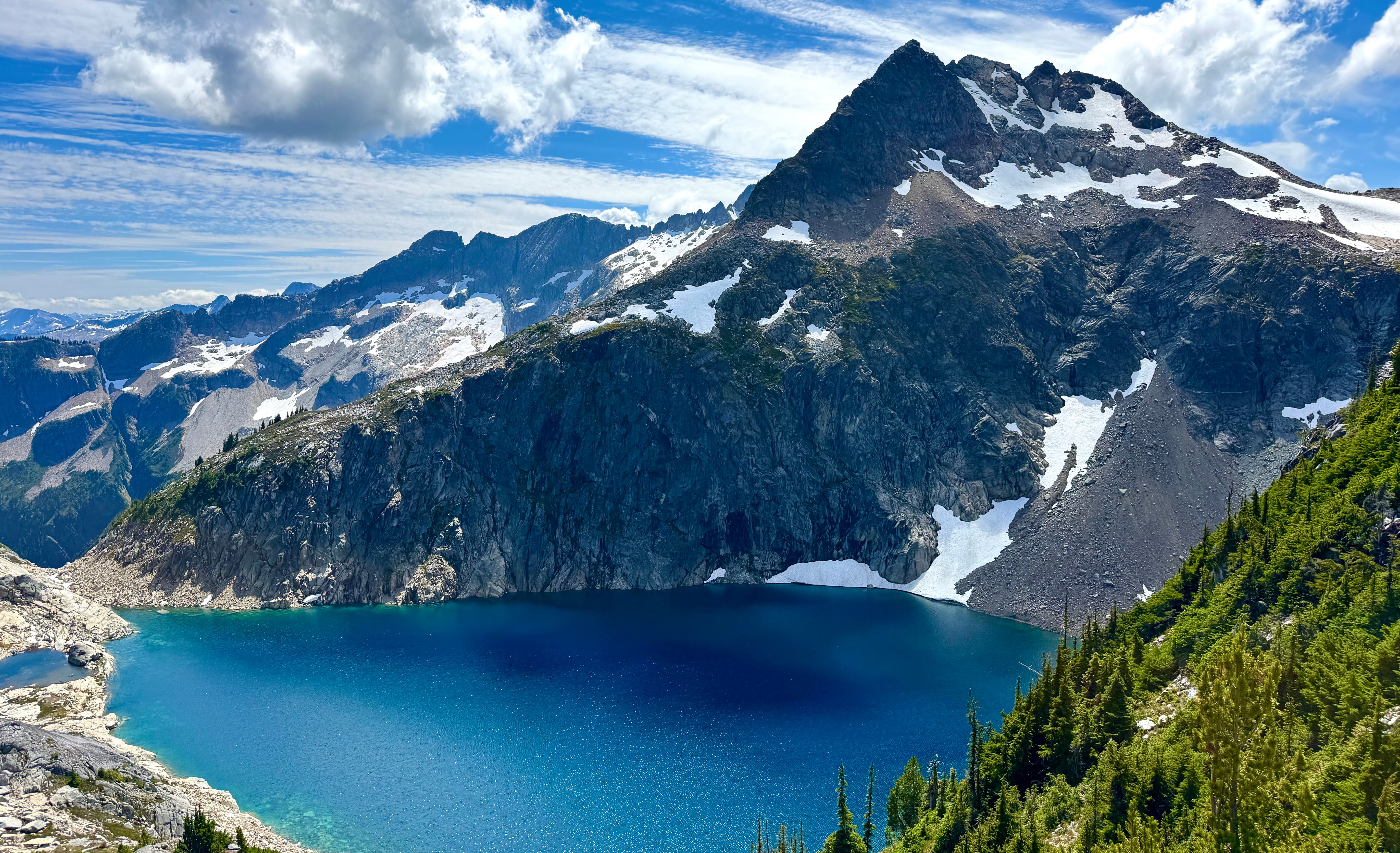
Hanging Lake via Mount Lindeman Trail
Distance: 5 km round trip | Elevation Gain: 150 meters | Difficulty: Easy
Hanging Lake beneath Mount Lindeman represents the pinnacle of alpine lake adventures accessible from Vancouver. This ultra-remote destination offers perhaps the clearest alpine water in southwestern BC, but accessing it requires genuine mountaineering skills and complete self-sufficiency that puts it in a category beyond typical hiking.
The route follows an unmaintained climbers' path gaining over 1,200 m through dense forest, muddy creek beds, and loose rock slopes. The initial forest climb gains 300 m in the first kilometer, often following creek beds, before a near-vertical final approach that becomes treacherous when wet. Navigation challenges and extreme steepness make this suitable only for very experienced hikers with proven route finding skills.
Upper Hanging Lake sits at 1,735 m in a spectacular cirque where crystal-clear water reflects Mount Lindeman's imposing north face. The sense of achievement matches the stunning scenery: few places near Vancouver offer such pristine wilderness solitude. A 4×4 vehicle is mandatory for Center Creek FSR access, while no cell service throughout the route makes satellite communicators essential for safety. This route has generated search and rescue calls when hikers underestimated difficulty or lost the route.
Frequently Asked Questions
Vehicle Requirements and Cell Coverage
Most lakes (Falls, Lindeman, Elfin, Eaton) are accessible with any car in good weather. Rohr Lake's forest service road can shorten your hike with high-clearance vehicles. Only Hanging Lake requires mandatory 4×4 for the rough Center Creek FSR. Cell coverage exists only at Falls Lake and sometimes Elfin Lakes. Plan as completely off-grid for the others, and consider satellite communicators for remote destinations like Rohr and Hanging Lake.
Best Time to Visit
Spring (April-June): Lindeman and Falls Lakes offer vibrant forests as snow melts. Summer (July-August): All lakes accessible with optimal conditions but expect crowds. Fall (September-October): Best for experienced hikers with spectacular colors and fewer people. Winter: Only Elfin Lakes (snowshoe/ski) and Falls Lake remain accessible.
Wildlife Safety
Black bears inhabit all areas with highest activity during late summer berry season. Proper food storage is mandatory for all destinations, with bear spray recommended for remote locations. Mountain goats frequent higher peaks around several lakes. Weather changes rapidly in alpine environments, so always carry extra layers and be prepared for afternoon thunderstorms.
Additional Sources:
Stewart Tourism Auto Tour PDF
Signature Experiences: Salmon Glacier


